To address the increasing challenges brought by extreme weather events, Taipei City has adopted the “Sponge City” strategy, a resilient urban approach that enhances the city’s ability to absorb and manage rainwater. The foundations of this policy were laid as early as the early 2000s, when the Taipei City Government launched the Comprehensive Flood Management Strategy. This strategy was designed for highly urbanized environments like Taipei, where conventional flood drainage systems had already reached their expansion limits. Rather than relying solely on traditional infrastructure development, the city implemented a multi-pronged approach focusing on “water retention upstream, flood mitigation midstream, and flood protection downstream. “These coordinated measures collectively enhance the city’s capacity to manage floods more effectively.
As part of the midstream flood mitigation component of the Comprehensive Flood Management Strategy, one of the key tasks has been the installation of detention facilities in flood-prone catchment areas to strengthen their overall flood prevention capacity.
This detention and desilting basin is located in the Dahu Catchment Area of the Kangning Pumping Station system in Neihu District. It was developed in response to extreme rainfall brought by Typhoon Winnie in 1997 and Typhoon Nari in 2001, which exceeded design thresholds and overwhelmed the downstream stormwater drainage system, causing significant damage to nearby residents and property. To address the recurring issue of flash floods near Dahu Shanzhuang Street in Neihu District, the city planned the construction of a detention and desilting basin at the northern end of the street, where Dagou River meets the underground box culvert. The facility was designed to delay runoff from the surrounding hills and capture sediment before it entered the drainage network. Planning and design began in March 2001, construction was tendered in March 2004, and work commenced in August 2005. The project was completed in April 2008, becoming Taipei’s first detention basin to incorporate ecological flood retention features.
Dagouxi Riverside Park Entrance Monument

Catchment area diagram and comparison of flooded streets During Typhoon Nari and normal conditions


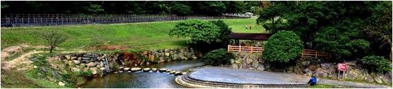
(I) Dagouxi Riverside Park is located at the northern end of Dahu Shanzhuang Street, where Da-gou River connects to the local drainage system. The Park covers approximately 4.59 hectares and serves a catchment area of around 327.52 hectares. It has a maximum flood detention capacity of 131,500 cubic meters and adopts a composite (side-weir) detention design. This system enables water to be automatically retained and released, with no pumping systems installed, in line with the principles of sustainability and energy conservation. The Park was designed and constructed adopting eco-engineering methods to restore wetland habitats and maintain healthy ecosystems, creating a space where flood management and ecology are integrated.
(II) The detention basin operates in harmony with Dagou River’s natural topography. Under normal conditions, riverflow is directed through a headgate into the inner river channel, where it passes through a single-cell box culvert and vertical shaft to enter the downstream drainage system. When intense rainfall occurs, the headgate is closed and water is rerouted into a side-weir open channel on the outer bank. This channel connects to the vertical shaft and drains into the downstream system. When inflow from upstream exceeds the drainage capacity of the downstream sewer, the connection to the drainage system is automatically shut. At that point, the water from the raised side-weir channel begins to spill into the detention basin, where it is temporarily stored to ease the pressure on the system. Once the flood peak subsides and downstream water levels drop, the connection reopens and water is gradually released from the basin.
Visitor map of Dagouxi Riverside Park

Site layout of Dagouxi Riverside Park

Diagram of flood detention mechanism – 1

Diagram of flood detention mechanism – 2

(I) Integrated Flood Control and Ecology
1. In-channel design during normal dry conditions: Maintains the existing ecological and recreational functions of Dagou River, preserving its natural habitat and water-friendly environment.
2. Off-channel design for flood control: When inflow exceeds the maximum discharge capacity of the side-weir channel, excess water overflows into the detention basin to begin storage. This design avoids the common drawback of traditional detention basins, which start retaining water immediately upon the onset of rainfall.
(II) Automatic Water Retention and Release Mechanism (Sustainable and Eco-Friendly)
1. The detention basin operates based on Dagou River’s natural gradient. A tongue valve at the downstream vertical shaft controls the outflow. When the shaft’s water level rises beyond a certain point, the valve closes and the basin begins storing water. Once the vertical shaft’s water level drops below the basin’s, the valve reopens and the water is released.
2. This eliminates the need for traditional pumps to discharge stored runoff, making maintenance easier and supporting energy efficiency and carbon reduction goals.
(III) The river channel is constructed adopting ecological engineering methods, providing both permeability and accessibility to water.
(IV) Drop structures are incorporated into the channel design to reduce the elevation difference along the riverbed. This helps slow the stream’s velocity, dissipate flood energy, prevent channel erosion, and protect the foundation of riverbank reinforcements.
River channel constructed using ecological engineering methods

Drop structure

2013 FIABCI-Taiwan Real Estate Excellence Awards –Best Environment & Culture Category – Excellent Award
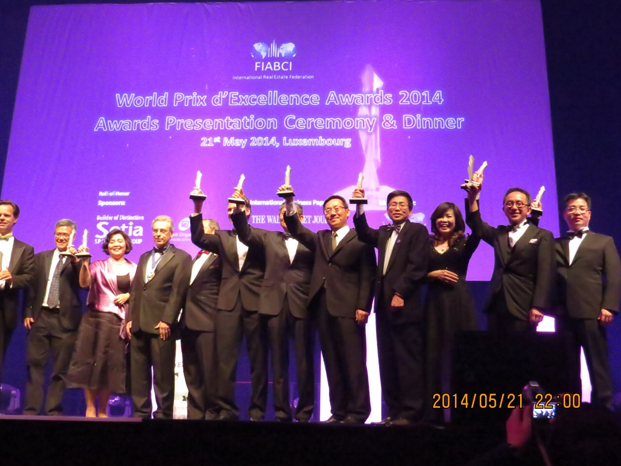
2014 FIABCI World Prix d’Excellence Awards – Silver
The spatial layout of Dagouxi Riverside Park seamlessly blends natural scenery with flood control engineering. To minimize ecological and visual impacts, the original river channel was preserved, and features such as artificial wetlands and ecological ponds were introduced to create inviting, water-friendly spaces. This approach allows the flood control infrastructure to harmonize with the natural environment, offering both functional resilience and aesthetic value. During dry periods, the park serves as a relaxing recreational space for the public. In flood seasons, it effectively reduces peak flow volumes to mitigate flood risks. In addition, the park connects to several mountain trails, forming a scenic and family-friendly green corridor ideal for day trips and nature outings.
Trail map of the Wuzhishan mountain system

Nearby attractions and recreational hotspots

The Platform and Trail of Dagouxi Waterfront


Dagou River features a water-friendly trail lined with diverse and ever-changing scenery. Along the way, visitors will pass through marshlands filled with aquatic plants, tranquil ponds and streams, fast-flowing channels where rocks create natural rapids, grassy slopes, native plant clusters, dense foliage, small bridges, and pavilions. Many elements of the stream’s ecological engineering are thoughtfully integrated into the landscape. The park’s ecological richness is equally impressive. From May to September, butterflies and dragonflies can be seen fluttering near the trail entrance. Nearly one-third of Taiwan’s native frog species can also be observed up close along Dagou River. The surrounding forested hills support diverse habitats, making encounters with local wildlife a common delight. Visitors may spot the soft-furred red-bellied tree squirrel or catch a glimpse of the vibrant Taiwan blue magpie as it gracefully glides among the treetops. During summer evenings, the chorus of insects and frogs fills the air, accompanied by the gentle murmur of the stream, creating a natural symphony that evokes the feeling of an open-air concert under the stars.
Wetland habitat creation and ecological river restoration


Address: End of Dahu Shanzhuang Street, Neihu District, Taipei City
Transportation:
Bus: Take a bus to “Dahu Park Station.” Enter from Dahu Shanzhuang Street and walk past Dahu Elementary School to reach the destination.
MRT and bus transfer: Get off at Dahu Park Station.
Transfer Bus Stop Name | Bus Route Information |
|---|---|
A. MRT Dahu Park Station, Exit 1 | [247–Hengyang Road] [247 Express–Hengyang Road] [247 Shuttle–MRT Yuanshan Station] [287–Hengyang Road] [287 Shuttle–MRT Yuanshan Station] [287 Night Service–Hengyang Road] [267–Tianmu] [677–MRT Yuanshan Station] [284–Jingmei] [683–Hougang Village] [620 (Guanghua Bus)–National Taiwan Science Education Center] [620 (Dayou Bus)–Shilin Vocational High School of Commerce] [681–Yangmingshan] [630–Dongyuan] [Brown 10–MRT Dahu Park Station] [Brown 19–MRT Dahu Park Station] [Red 2–MRT Yu-anshan Station] [Red 31–MRT Minquan West Road Station] |
B. MRT Dahu Park Station, Exit 2 | [247–Donghu] [247 Shuttle–Donghu] [247 Express–Donghu] [287–Donghu] [287 Shuttle–Donghu] [287 Night Service–Donghu] [267–MRT Dahu Park Station] [630–Donghu] [681–Donghu] [284–Shehou, Xizhi] [617–Xinzhuang] [620–China University of Science and Technology] [677–Shehou, Xizhi] [683–Nangang Vocational High School] [Red 2–Shehou, Xizhi] [Brown 10–Nanjing–Fuxing Intersection] [Brown 19–Nangang Station] |
MRT: Take the Wenhu Line and get off at MRT Dahu Park Station. Exit via Exit 1, enter Dahu Shanzhuang Street, walk past Dahu Elementary School, and you will arrive at the destination.
Location map of Dagouxi Riverside Park


![Taiwan.gov.tw [ open a new window]](/images/egov.png)