Taipei City, situated within the Taipei Basin, is characterized by a low-lying terrain surrounded by mountains and rivers. Approximately 55% of the area consists of hillside regions, while the remaining 45% comprises flatlands. The city is encircled by five major mountain ranges: Datun, Qixing, Wuzhi, Nangang, and Erge. Additionally, four major rivers surround Taipei: the Tamsui River to the west, the Xindian and Jingmei Rivers to the south, and the Keelung River, which cuts across the city. Due to the low-lying terrain and the significant amount of rainfall during the summer, floods are frequent, especially when the downstream outlets are affected by tidal forces. Therefore, the flood control measures, as approved by the Executive Yuan in the Taipei Area Flood Control Project, primarily focus on the construction of embankments, complemented by river management and channel regulation. Urban stormwater runoff is managed through a drainage system and pumped out via pumping stations into the rivers (see Figure 1).
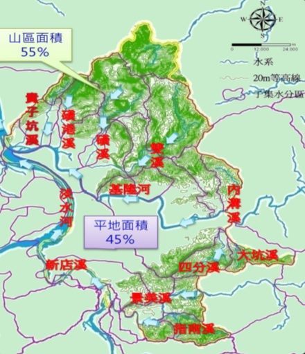
(Figure 1: Taipei City River Basins )
The Keelung River flows through the Beitou area downstream and merges with the Tamsui River at Guandu. Its tributaries include the Huanggang River, Guizikeng River, and Shuimokeng River, each briefly summarized below:
(I) Keelung River
The Keelung River is a crucial tributary of the Tamsui River, originating from Jingtongshan in Pingxi District, New Taipei City. The river spans approximately 86.4 kilometers, with a catchment area of around 490.77 square kilometers. It flows through Ruifang, Keelung City, and Xizhi District before entering Taipei City. Historically, the Keelung River's banks were prone to severe flooding due to its meandering channels and low-lying terrain, which slowed down floodwater discharge. The confluence of the Keelung River and the Tamsui River, up to the Nanhu Bridge, falls within the scope of the Taipei Area Flood Control Project. This area has been under flood control measures since 1963 as part of the broader Tamsui River Flood Control Project. Currently, only the Guandu embankment requires additional protective measures, with construction expected to align with the Guandu High-Level Protection Facility timeline. The Zhoumei embankment, in conjunction with the Beitou Shilin Technology Park, was completed in December 2020. The embankments downstream of Zhongshan Bridge, including Shezi, Shilin, and Yuanshan, were completed under the North District Flood Control Phase III Plan in 1988. By 1996, the river's bend correction and straightening projects were finished. The embankments upstream of the Nanhu Bridge, extending to the New Taipei City border, were also completed in 1996, meeting the flood protection standards for major rivers against a 200-year flood recurrence interval period.
(II) Guizikeng River and Shuimokeng River
The Guizikeng River originates between Huoshaoshan and Miantianshan (elevation 878 meters). It flows northeast to southwest, merging with Shuimokeng River at Xiushan Road, then traversing Daoxiang Road, Zhongyang North Road, and Dadu Road before joining the Keelung River at Xia Baxian. The river spans approximately 7.24 kilometers with a catchment area of around 3.77 square kilometers, making it a tributary of the Keelung River. Shuimokeng River's floodwaters are intercepted at Xiushan Road and diverted into Guizikeng River. The river is approximately 3.24 kilometers long, with a catchment area of around 1.32 square kilometers. The previous Shuimokeng River, after being rerouted, now functions as an urban drainage system, flowing through Zhonghe Street, Datong Street, Wenhua 1st Road, and Daye Road, eventually merging with the old Guizikeng River to form Zhonggang River before entering the Tamsui River at Guandu Temple.
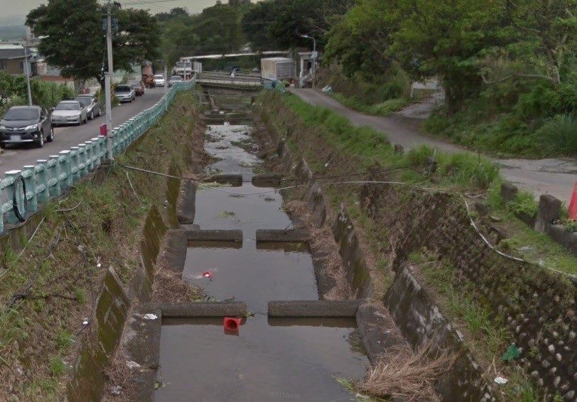
Upstream of Shuimokeng River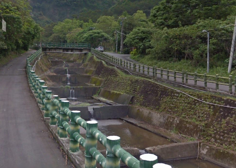
Upstream of Guizikeng River
The Guizikeng River catchment area ranges in elevation from EL.2m to EL.878m, resulting in a significant elevation difference. The riverbed has an average slope of approximately 12.10%. The Shuimokeng River, with an elevation drop of about 732m, has an average riverbed slope of around 22.59%. The boundary between the mountainous and flat areas of these rivers is roughly delineated by Zhongyang North Road, with the mountainous region to the north and the flatlands to the south. The main channel of the Guizikeng River extends approximately 4.7 kilometers through mountainous terrain and 2.54 kilometers through flatlands, while the upstream section of the Shuimokeng River is entirely within mountainous terrain.The current state of the Guizikeng and Shuimokeng Rivers includes the completion of remediation work on the upstream sections (north of Zhonghe Street) and downstream sections (from Zhongyang North Road to the confluence with the Keelung River) in 1982. The midstream section (from Zhonghe Street to Zhongyang North Road) was completed in 1987. These sections were developed as concrete-lined channels designed to meet the protection standards for a 50-year flood recurrence interval period.
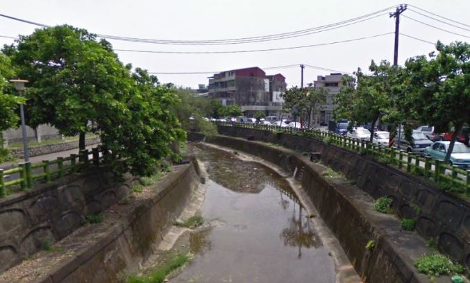
Midstream of Guizikeng River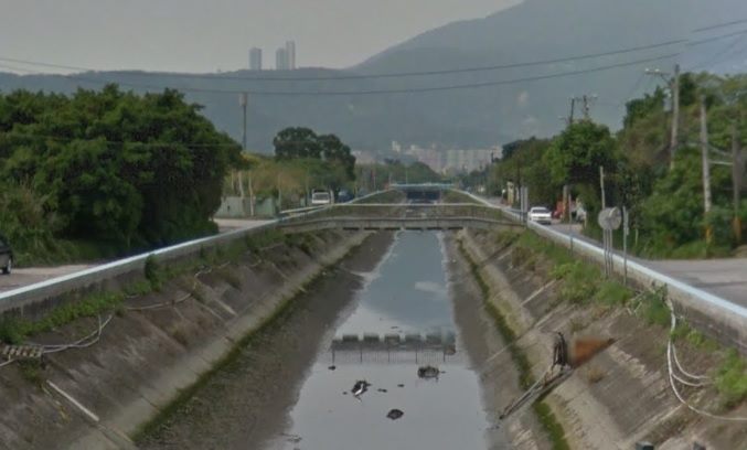
Downstream of Guizikeng River
(III) Huanggang River
Huanggang River is a tributary within the Keelung River basin of the Tamsui River system. The river originates from the southern and western peaks of Datun Mountain, within the jurisdiction of Yangmingshan National Park. It flows into the New Beitou area (see Figure 3), where tributaries such as Beitou River and an unnamed stream merge near Beitou MRT Station and Fuxing Park. The river flows past Wego Elementary School, Beitou Market, Zhongyi New Village, crosses Chengde Road Section 7 via Chaolai Bridge adjacent to the former Tatung Electronics Factory, and ultimately meets the Keelung River near Zhong Baixian. The Huanggang River catchment area is bordered on the west by the Guizikeng River watershed, to the north by Datun Mountain, to the east by the Huang River watershed, and to the south by the Wufen Port drainage basin (see Figure 4).
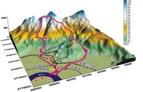
(Figure 3: Topographic Map of Huanggang River Catchment Area )
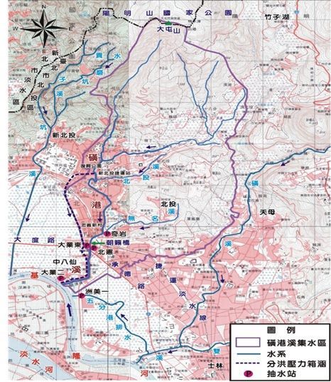
(Figure 4: Geographical Location and Environmental Drainage System Map of Huanggang River)
The main water channel of Huanggang River is approximately 8.23 kilometers long, with elevations ranging from EL.2m to EL.985m, resulting in a significant elevation gradient. The riverbed has an average slope of approximately 1/22. Beitou River is one of the tributaries of Huanggang River, originating from the geothermal valley located above Beitou Park, at the base of Zhongshan Road in an elongated elliptical mountain valley with a fissure depression. It then flows through Beitou Park and Qixing Park, passes several small bridges, and joins Huanggang River at Qihu Park. The length of Beitou River is approximately 1.93 kilometers, with a catchment area of 1.58 square kilometers, and elevations ranging from EL.7m to EL.275m, resulting in a significant elevation drop and an average riverbed slope of approximately 1/7.
Due to Huanggang River flowing through the prime area of Beitou District, the ability to effectively drain floodwaters and prevent flooding during typhoons and heavy rains has been a key concern for the municipal government. Historically, the rehabilitation of Huanggang River was conducted in sections. The Maintenance Office (now the Hydraulic Engineering Office) of the Public Works Department allocated budgets in the years 1975-1976 for river channel engineering works between Chaolai Bridge and Beitou Bridge, including approximately 100 meters of river segment upstream of Beitou Market for covered river construction. Additionally, in 1980, the Maintenance Engineering Office completed the rehabilitation of the river channel between Beitou Bridge and Wego Elementary School.

As Beitou District has grown increasingly prosperous with a rising population and accelerated development driven by the MRT Tamsui Line, it has become imperative to reassess the flood control capacity of the Huanggang River. The areas through which the Huanggang River flows encompass key regions of Beitou, making effective flood management critical. According to an analysis report by the Public Works Department’s Maintenance Office in September 1990, the current river channel of the Huanggang River does not meet the flood protection standards for a 50-year flood recurrence interval period. Consequently, in June 1994, the Maintenance Office commissioned a professional consulting firm to complete the "Huanggang River Remediation Project Report." This report provided recommendations for improving the river's flood discharge capacity, serving as a blueprint for the design and execution of the Huanggang River Remediation Project. In alignment with the development needs of the "P20 Road Surrounding Urban Plan" and the environmental requirements around the market area, the Maintenance Office undertook phased covering of the river from Huanggang Bridge to Yanshou Bridge in 1998 and 1999, spanning approximately 900 meters (see Figure 5).
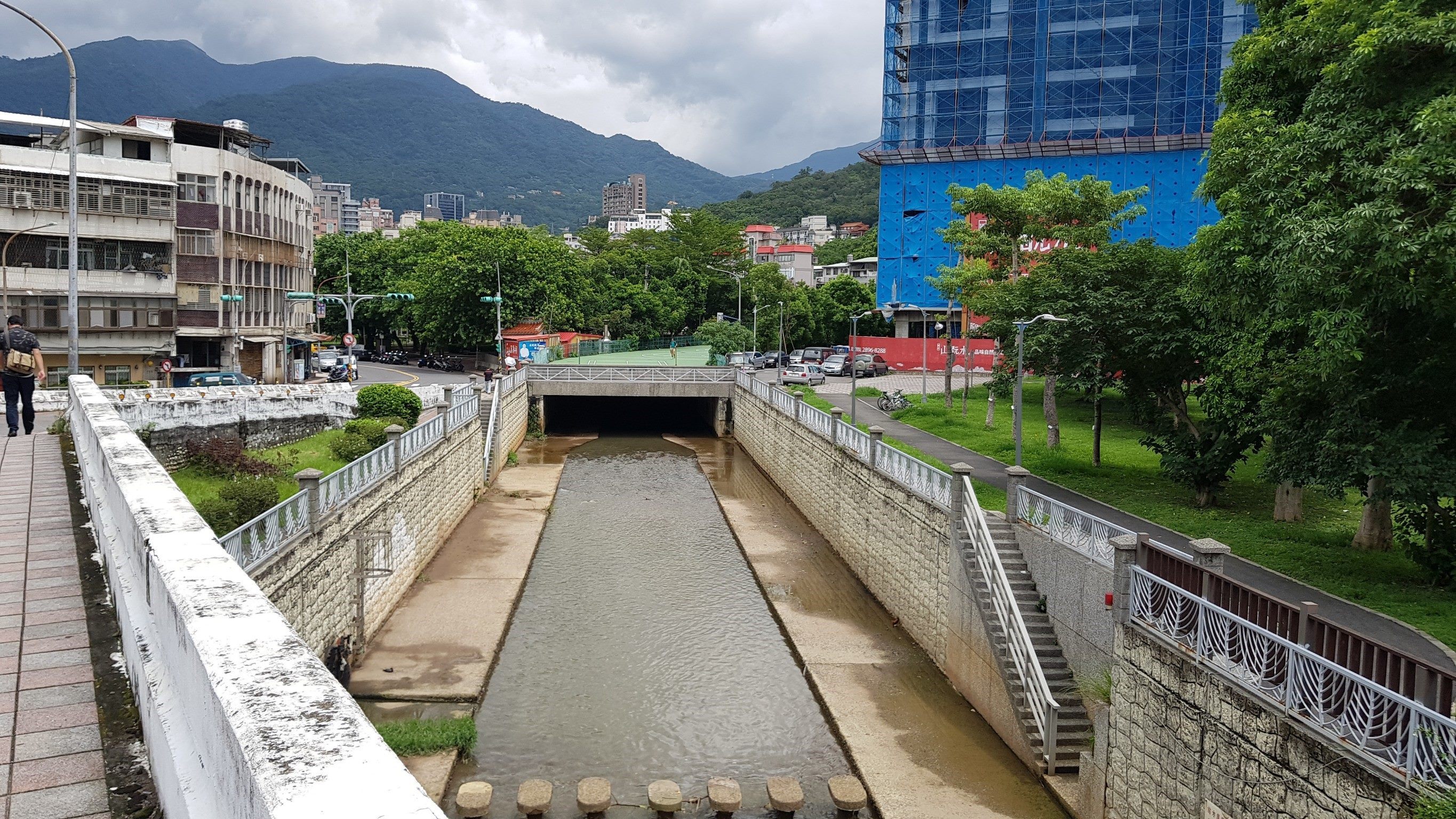
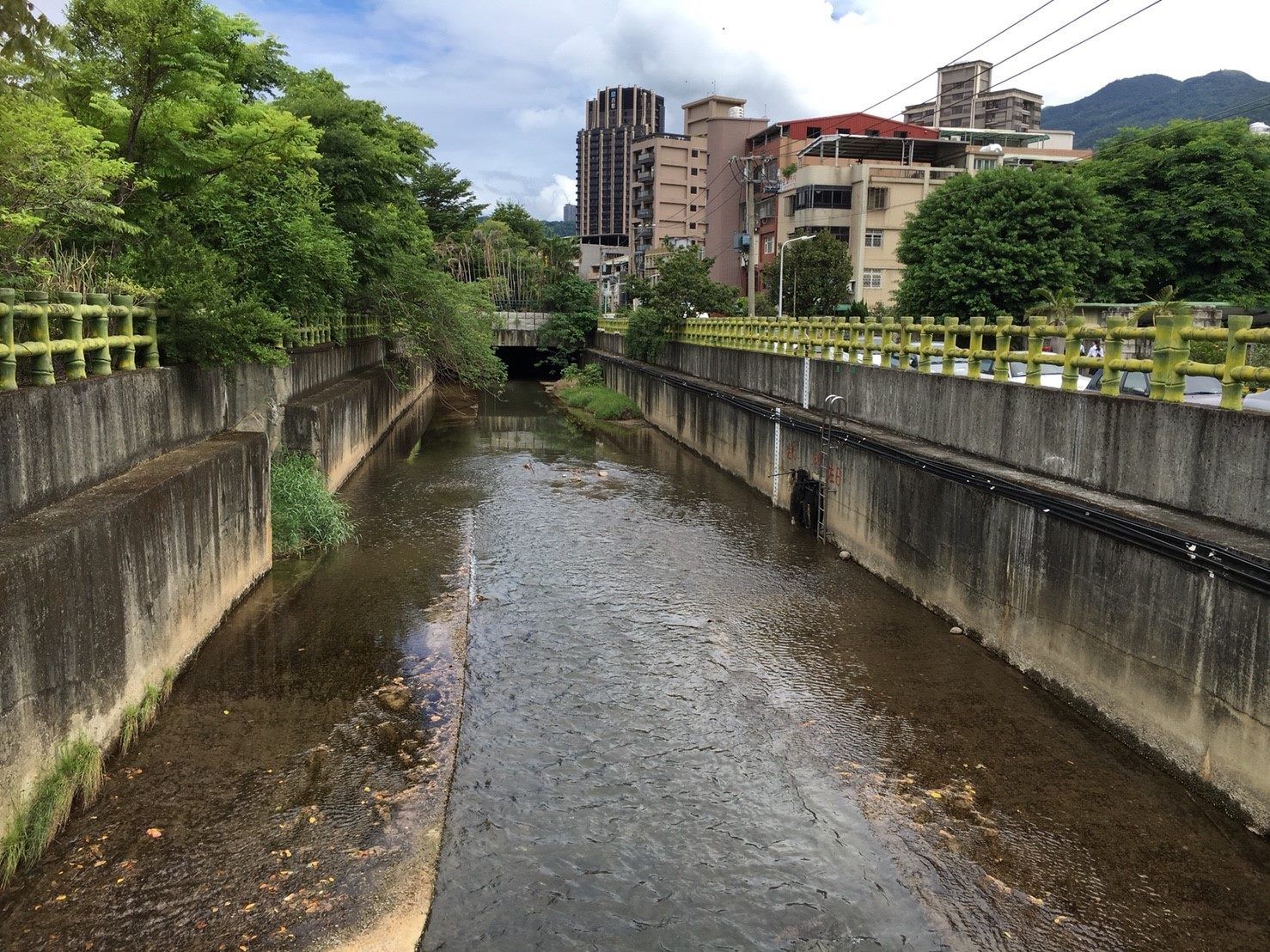
Current conditions of Huanggang River middle reaches(Huanggang Road Bridge).
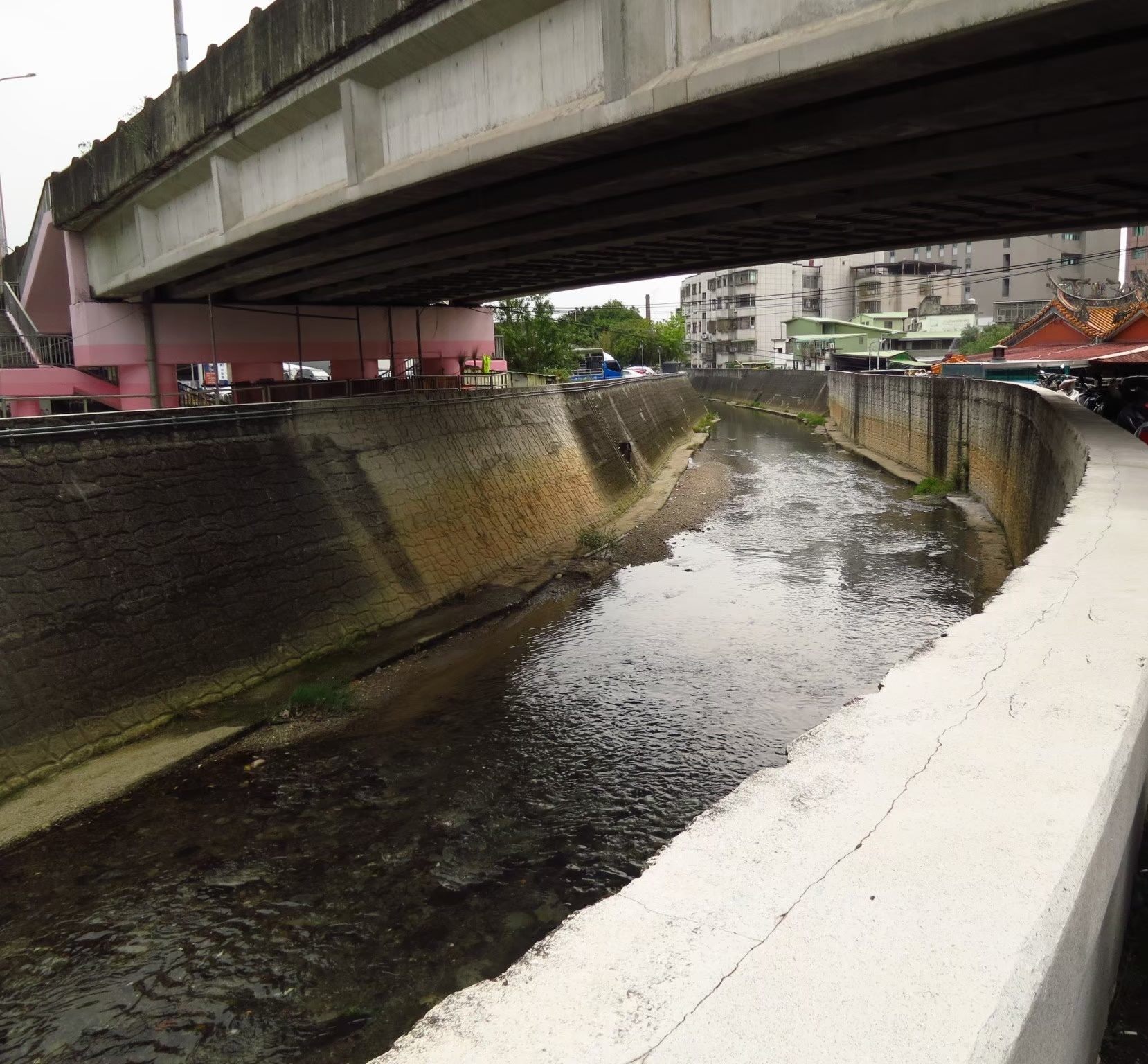
Current conditions of Huanggang River middle reaches(near Gongguan Road)
Current conditions of Huanggang River lower reaches (Xian Bridge area).
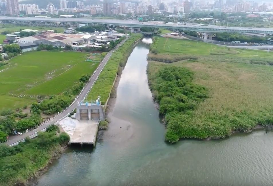
Current conditions of Huanggang River lower reaches (the confluence with Keelung River).
(Figure 5: Current Conditions of Huanggang River Upper, Middle, and Lower Reaches)
Given that the existing river channel could only handle a 10-year flood recurrence interval, with insufficient capacity for a 50-year flood event, and considering the highly developed nature of the areas along both sides of the river—where some houses were too close to the river to allow for embankment elevation—the Maintenance Office conducted a detailed evaluation. It was determined that a solution involving a pressure culvert for flood diversion would be most effective. This approach would avoid the need for demolishing homes along the main river channel while providing flood protection for the residents. The pressure culvert flood diversion project for Huanggang River involved installing a pressure culvert along the central divider of Daye Road, starting from Zhongyong Park No. 2 in Beitou. To mitigate the impact of construction and account for the existing elevation and underground utilities, the culvert was rerouted near Shixin Industrial and Commercial School, moving into the agricultural area on the west side of Daye Road. The culvert then crosses Dadu Road, running along the Zhoumei Expressway right-of-way before turning southwest at the intersection with the Guandu Flood Control Embankment, where it discharges into the Keelung River (see Figure 6).Construction of the Huanggang River pressure culvert project commenced in 2003 and was completed in 2009, with a total length of 3.4 kilometers. After completion, the river's regular flow continues along the original channel into the Keelung River. However, during typhoons and heavy rainfall, when the river's water level reaches the stilling basin elevation at EL.11m, the water automatically overflows into the pressure culvert for diversion into the Keelung River. This effectively alleviates the upstream flood volume during typhoons and storms, thereby preventing flooding in the urban area of Beitou District.
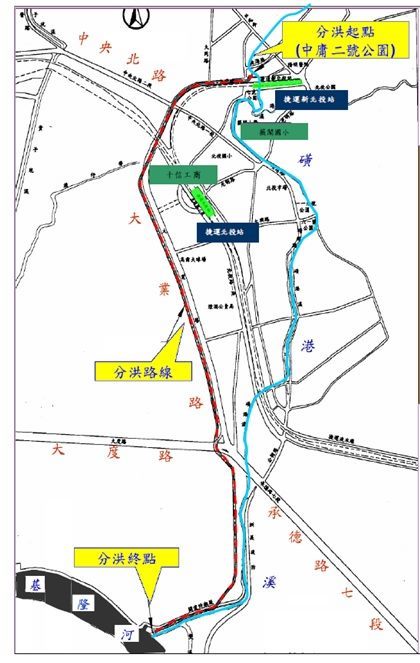
(Figure 6: Huanggang River Flood Diversion Route Plan View)
The Huanggang River, flowing through the heart of Beitou District, is intricately linked to the development of local communities and the daily lives of its residents. This project aims to restore and enhance the Huanggang River by integrating various elements, optimizing the blue-green infrastructure, and employing low-impact development techniques. The goal is to reconnect Beitou’s “Mother River” with its natural environment and historical significance, thereby reinvigorating the area’s ecological and cultural value.
(I) Enhancing flood control capabilities in response to climate change through the Huangang River Reengineering Project:
The reengineering of the Huanggang River addresses the challenges posed by climate change and increases flood control capacity. With frequent rainfall and intense urbanization leading to increased impermeable surfaces, traditional embankment-based flood control methods have become insufficient. This project will assess the feasibility of reengineering the Huanggang River, proposing more appropriate solutions tailored to the varying conditions along its course to improve flood retention and response capabilities.
(II) Integrating spatial interfaces to create open activity areas:
The reengineering of the Huanggang River addresses the challenges posed by climate change and increases flood control capacity. With frequent rainfall and intense urbanization leading to increased impermeable surfaces, traditional embankment-based flood control methods have become insufficient. This project will assess the feasibility of reengineering the Huanggang River, proposing more appropriate solutions tailored to the varying conditions along its course to improve flood retention and response capabilities.
(III) Implementing low-impact development to enhance the ecological landscape system:
The project will incorporate low-impact development techniques such as permeable pavements, vegetated swales, and natural drainage systems. The objective is to create a more integrated flood control and ecological landscape system by allowing water to be retained in various layers.
(IV) Execution plan: Reengineering of the Huanggang River from Huanggang Bridge to the confluence with the Keelung River (divided into five sections) (see Figure 7):
The project envisages to remediate the forgotten streams, set a benchmark for river restoration, and reestablish the connection between the waterfront and urban life. By restoring the natural landscape of the Huanggang River—once regarded as the "Mother River"—the project will reinforce the interdependence between humans, nature, and water. This initiative will also integrate local history, natural ecology, and waterfront values while promoting water-friendly urban development and education.
(1) Section A: Huanggang Bridge to Guangming Road (Covered Section): Starting from Guangming Road and moving north, this section includes the covered portion of Huanggang River (with the exception of an 80-meter stretch next to Dafeng Park). This area is an important commercial and residential area in Beitou District, with significant activity around markets and housing. Therefore, the covered section and its surroundings have become vital green spaces, recreational areas, and fitness zones, including Dafeng Park, Huanggang Park, and Chang'an Park. These parks are equipped with children's playgrounds, inclusive play spaces, basketball courts, parking facilities, skating rinks, and rehabilitation fitness areas on the covered structure.
(2) Section B: Guangming Road to Yanshou Bridge: This section extends from Guangming Road to Yanshou Bridge beside Huanggang Park, located near Beitou and Xinbeitou MRT stations, the market, and the core downtown area of Beitou. As the political and economic hub of Beitou, this section's reengineering has yet to commence and will be evaluated and planned after the renovation of Beitou Market.
(3) Section C: Yanshou Bridge to Xi’an Bridge: The section from Yans-hou Bridge southward to Xi’an Bridge features Huanggang River's three-sided concrete embankments. The east side, adjacent to the Qiyan Redevelopment Zone, includes Qiyan Park No. 1 and Qiyan Park No. 2, characterized by expansive lawns, walking trails, rest pavilions, ecological ponds with wooden platforms, and children's playgrounds. On the west side, traditional apartments and condominium buildings dominate, with a pedestrian path running along the river. However, due to topographical changes, parts of the path are discontinuous, failing to provide a fully accessible walking system.
(4) Section D: Xi’an Bridge to Chaolai Bridge: This section runs alongside buildings and industrial zones, with limited open spaces. The only related facilities include Qingjiang Park No. 1, Qingjiang Park No. 2 (with workout equipment), and a pedestrian path along Huanggang River. However, the path is often obstructed by parked motorcycles, impacting its accessibility.
(5) Section E: Chaolai Bridge to the confluence with the Keelung River: This section’s embankment closely borders adjacent buildings. After crossing Chengde Road, Huanggang River flows past areas primarily occupied by factories, with a lack of pedestrian paths. However, the river's outlet connects with the Keelung River bikeway.
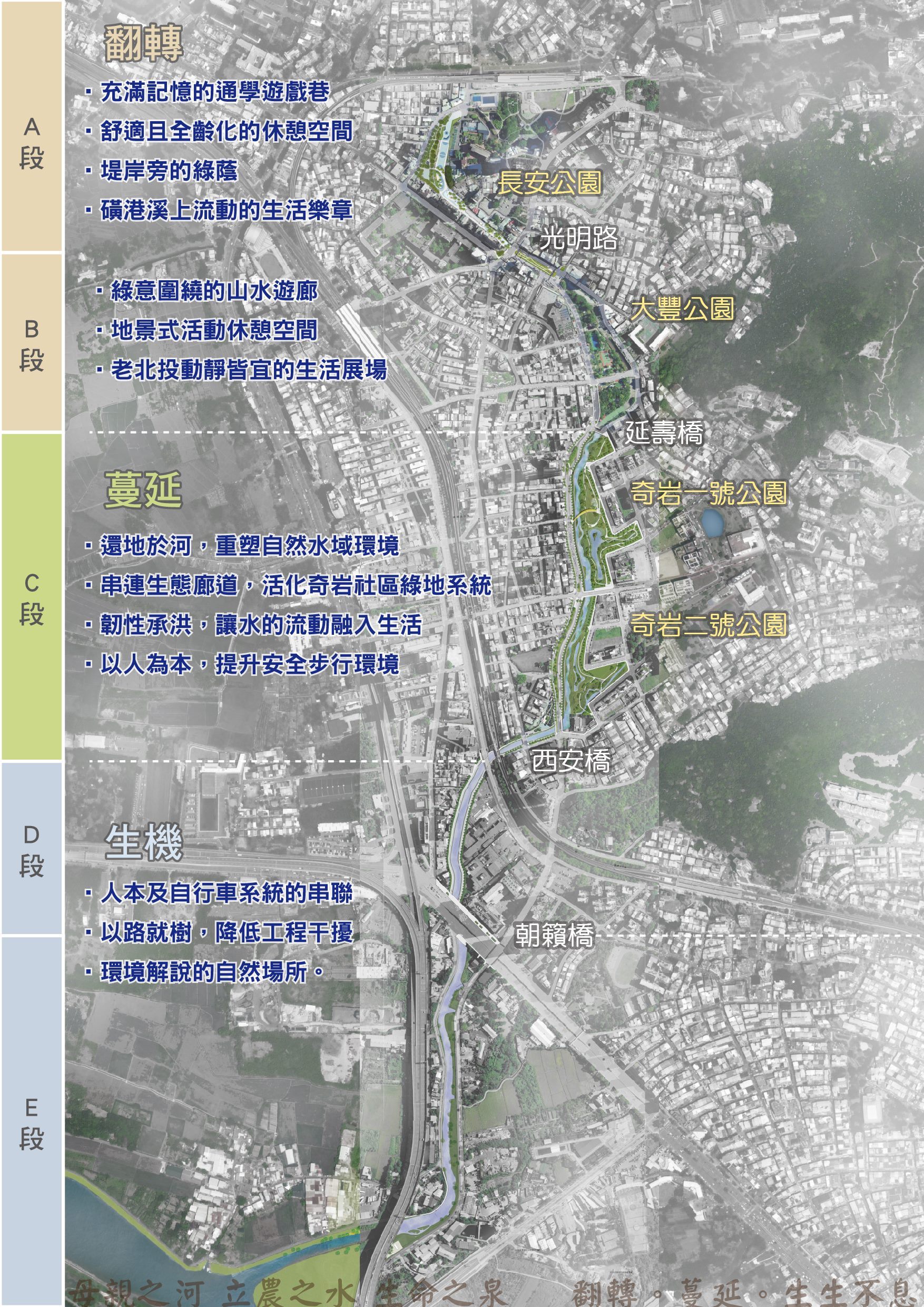
(Figure 7: Huanggang River Reengineering Project Details)

![Taiwan.gov.tw [ open a new window]](/images/egov.png)
